Nichijou Anime Pilgrimage: The Nichijou Daily Calendar Edition
This page introduces the real-life locations used as models for the jacket illustrations of the anime “Nichijou” drama CD series, “Nichijou no Himekuri CD.”
*A total of 4 locations. All are located within Gunma Prefecture. Information is current as of 2025.
Table of Contents
- 1 Jacket Illustrations and Model Spots
- 1.1 Vol. 1: Inside Kezoji Park (Isesaki City, Gunma)
- 1.2 Vol. 2: Benten-dori Shopping Street South Entrance / Chiyoda-machi Crossing (Maebashi City, Gunma)
- 1.3 Vol. 3: Ryomo Line Railroad Crossing (Isesaki City, Gunma)
- 1.4 Vol. 4: Benten-dori Shopping Street North Entrance / Hirose River Hitone Bridge (Maebashi City, Gunma)
Click here to check the holy sites on Google Maps
https://maps.app.goo.gl/S5jvHgszBUJqPgwx8?g_st=i
What is “Nichijou no Himekuri CD” in the first place?
Released in 2011, this is a spin-off drama CD series of the anime “Nichijou.” Unlike typical anime drama CDs, it follows a “daily calendar” format where characters mutter about their daily events like a diary. It contains 366 days worth of recordings from April to March of the following year. Based on the existence of the February 29th part and the alignment of the days of the week, the timeline of the CD likely spans from April 2011 to March 2012.
Since the voice dramas are linked to the anime’s content, they offer deeper psychological descriptions and behind-the-scenes details not found in the show, making it a must-listen series for “Nichijou” fans.
There are four CDs in total (Vol. 1 to Vol. 4), each containing three months of voice dramas. The cover illustrations feature spots modeled after locations in Isesaki City and Maebashi City, Gunma Prefecture.
Jacket Illustrations and Model Spots
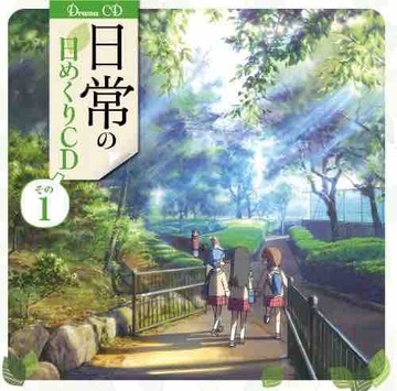
Vol. 1: Inside Kezoji Park (Isesaki City, Gunma)
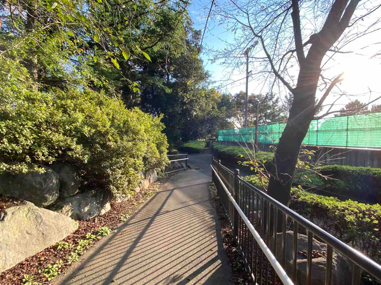
A lush, green illustration perfect for the spring season. The landscape on the jacket is a pedestrian intersection located on the northwest side of the roller coaster within Kezoji Park. Facing the direction of the jacket’s perspective, you will find the Isesaki City Tennis Courts.
Map
https://maps.app.goo.gl/to9VgmYC5C5hdUWt9?g_st=ipc
Vol. 2: Benten-dori Shopping Street South Entrance / Chiyoda-machi Crossing (Maebashi City, Gunma)
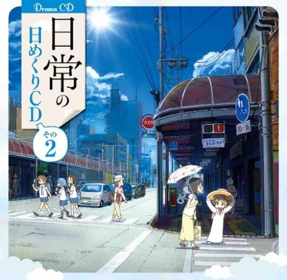
A summer townscape featuring a piercing blue sky and a scorching sun. The model is the south entrance of the shopping street in Chiyoda-machi, north of Maebashi Station. Standing at the crosswalk adjacent to Benten-dori and looking west, the view matches the jacket illustration.
Map
https://maps.app.goo.gl/A3XNnxJQJmMGUVkYA?g_st=ipc
Vol. 3: Ryomo Line Railroad Crossing (Isesaki City, Gunma)
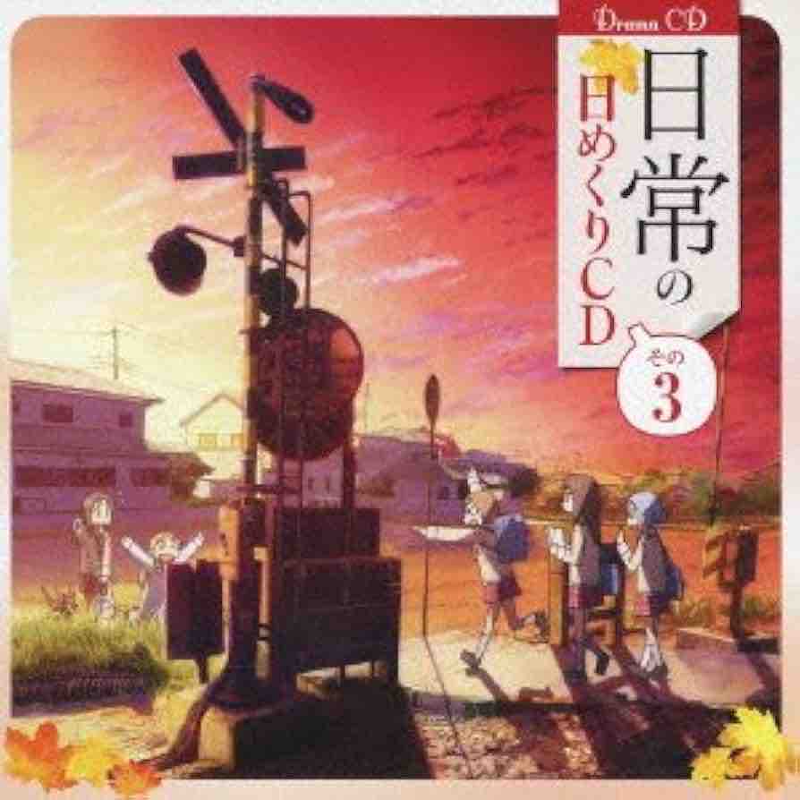
A street corner dyed in madder red, where you can almost hear “Yuyake Koyake” (Evening Glow) playing from somewhere. This is an iconic shot where the two “dailies”—Yukko’s group and the Shinonome household—intersect across the railroad crossing.
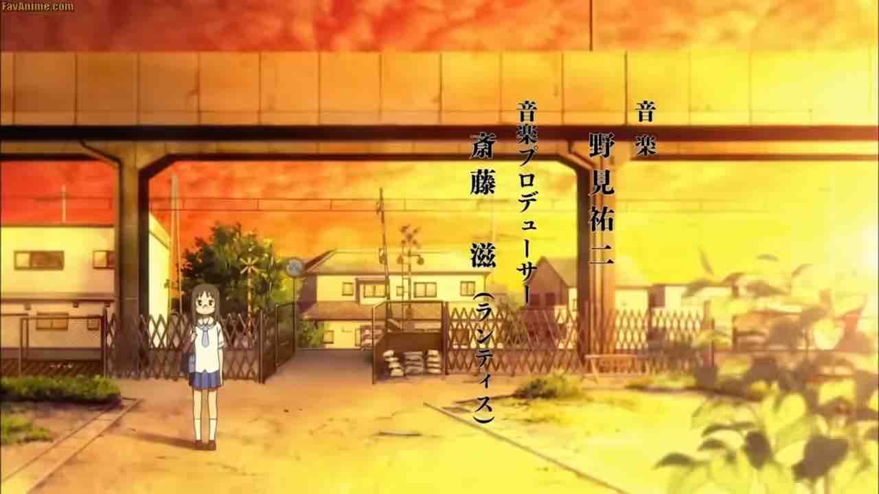
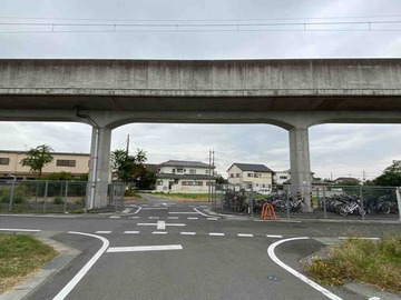
This is the same railroad crossing used for the background shot where Mai stands in the second anime opening. The jacket illustration depicts the area before 2011 when the Ryomo Line was still at ground level. As of 2025, the tracks have been elevated, and the crossing shown in the jacket has been removed.
In the timeline of the main anime series, the elevation of the Ryomo Line has already been completed. Therefore, a scene where the two groups meet at a crossing like this is technically impossible in the main story, making this a very rare depiction.
Map
https://maps.app.goo.gl/7ETWMtPcGXAKvgp89?g_st=ipc
Vol. 4: Benten-dori Shopping Street North Entrance / Hirose River Hitone Bridge (Maebashi City, Gunma)
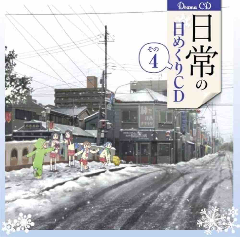
The main six characters engaging in a snowball fight in a silver-covered Tokisadame City. This illustration depicts a snowy landscape, which is quite rare in “Nichijou” across both the manga and anime.
This corresponds to the opposite entrance of the Benten-dori Shopping Street featured in Vol. 2. The bridge in the jacket is “Hitone Bridge,” known for its uniquely designed railings. If you look straight north from the arcade’s north entrance, you can see the same view as the jacket. However, since some buildings have been demolished as of 2025, it is no longer possible to see the view exactly as it appears on the CD cover.
Map
https://maps.app.goo.gl/wqv3cHzRpXckmKQd8?g_st=ipc