Nichijou Anime Pilgrimage Sites in Isesaki, Gunma
This page introduces real-life locations in Gunma, starting with Isesaki, that were used as settings in the anime Nichijou.
Table of Contents
- 1 What kind of place is Isesaki(伊勢崎)?
- 2 Access to Isesaki
- 3 Isesaki City
- 3.1 Shinonome Laboratory
- 3.2 Gunma Prefectural Isesaki Commercial High School (Tokisadame High School)
- 3.3 SUBARU Isesaki Plant Chimney
- 3.4 Kezoji Park Amusement Park
- 3.5 Kezoji Park South Intersection (Nichijou 2nd OP – Yukko’s Fast-Forward Part)
- 3.6 Hiragama River Bridge 4-1 (Nichijou 2nd OP – Mio’s Fast-Forward Part)
- 3.7 Under the Ryomo Line Viaduct (Nichijou 2nd OP – Mai’s Fast-Forward Part)
- 3.8 Under the Ryomo Line Viaduct (Nichijou 2nd OP – Nano’s Running Scene)
- 3.9 Hirose River Bank / Near Sakae Bridge
- 3.10 Mos Burger Isesaki Kezoji-mae
- 3.11 Intersection in front of the Shinkyo (Credit Union)
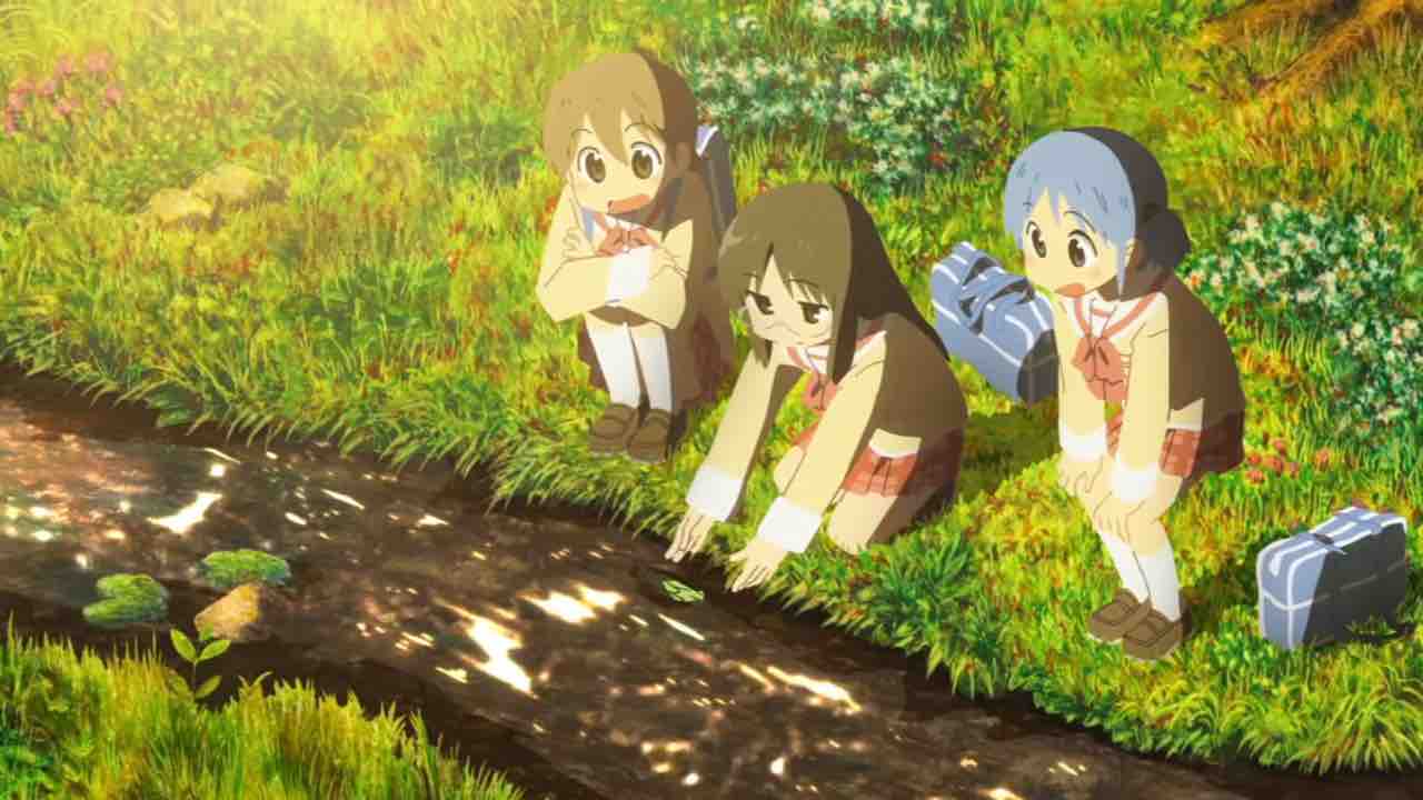
- 3.12 Kasukawa River Bank (Main Story)
- 3.13 Hirose River near Mitsuya Bridge
- 3.14 Kasukawa River Bank (1st ED)
- 3.15 Machikado Station Hirose
- 3.16 Kuruwa-cho, Isesaki City
- 3.17 Prefectural Road 74 Intersection
- 3.18 Tokue Shoten (Tokue Store)
- 3.19 Honmachi-dori
- 3.20 Beetle and Stag Beetle Objects (Tokisadame Park)
- 4 Maebashi City
- 5 Takasaki City
- 6 Pilgrimage Sites Where Scenery Has Vanished Due to Redevelopment
- 7 Bonus Section
Click here to check the Anime Pilgrimage Sites on Google Maps
Isesaki City (Anime – Existing)
https://maps.app.goo.gl/k2ryFq62sMV8sNJw9?g_st=i
Isesaki City (Anime – Demolished/Gone)
https://maps.app.goo.gl/qA8JEHVfavLmB872A?g_st=i
Isesaki City (Nichijou: Uchuujin Video Game)
https://maps.app.goo.gl/6e1bQYQcMsWcmnkPA?g_st=i
Maebashi, Takasaki, and Others
https://maps.app.goo.gl/txGrsCuBrQJEcM9dA?g_st=i
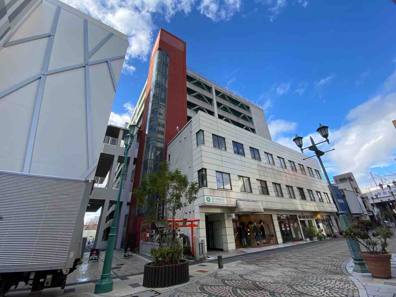
What kind of place is Isesaki(伊勢崎)?
The city is located in the southern part of Gunma Prefecture. The city has long been active in the production of silk. Today, it is an industrial city with many factories. Isesaki City is the birthplace of Arawi Keiichi. Therefore, the scenery of the city is used as the background of the anime “Nichijou”. As of 2023, the city has the largest number of sacred places for the “Nichijou” anime.
Access to Isesaki
From Tokyo Sta.
Tokyo Sta. → Jouetsu/Hokuriku Shinkansen → Takasaki Sta. → JR Ryomo Line → Isesaki Sta.
Isesaki City
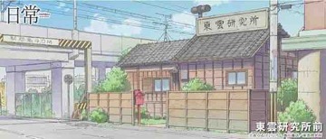
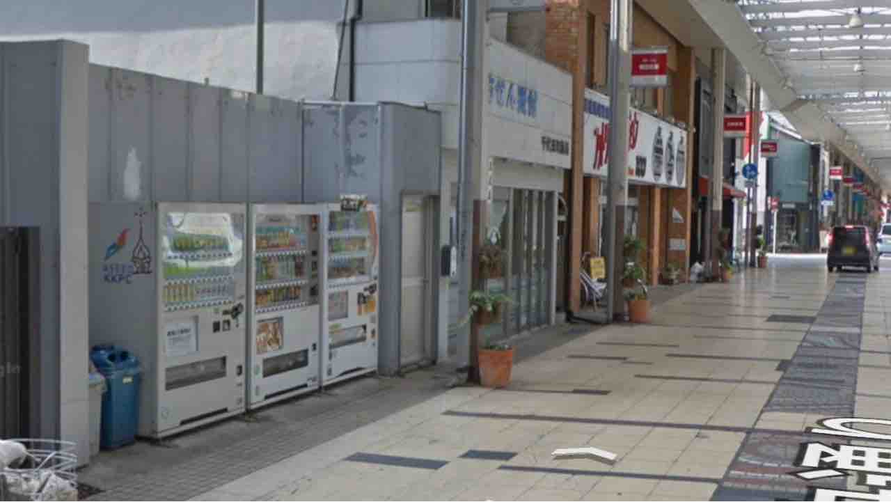
Shinonome Laboratory
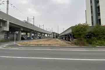
This is the model location for the land where the Shinonome Laboratory was built. Currently, the side near the elevated tracks is vacant land, and the side near the apartment building has become a parking lot.
At the time the anime was produced, there was reportedly a Japanese-style house that closely resembled the Shinonome Laboratory, but it was apparently demolished after the anime aired.
Because the adjacent railway viaduct and apartments maintain the scenery from that time, the atmosphere of the anime is strongly preserved despite the site being cleared.
Access from Isesaki Station is excellent, making it a must-visit spot if you are on a pilgrimage by train.
Map
https://maps.app.goo.gl/PufcAYW1aQvj6Tdo9?g_st=ipc
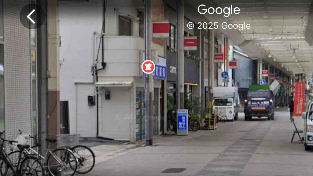
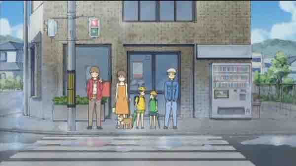
Gunma Prefectural Isesaki Commercial High School (Tokisadame High School)
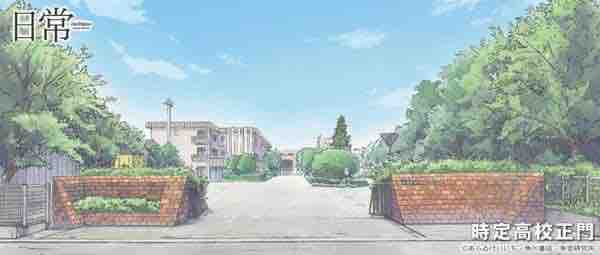
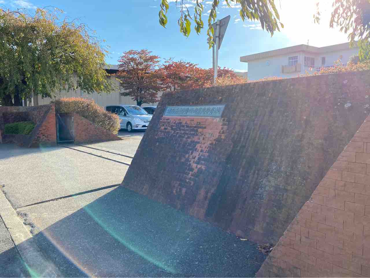
The high school that Yukko and her friends attend in the anime. It is modeled after Isesaki Commercial High School, which is the alma mater of the original author, Keiichi Arawi. Please be respectful and careful not to disturb the students and teachers who actually use these facilities.
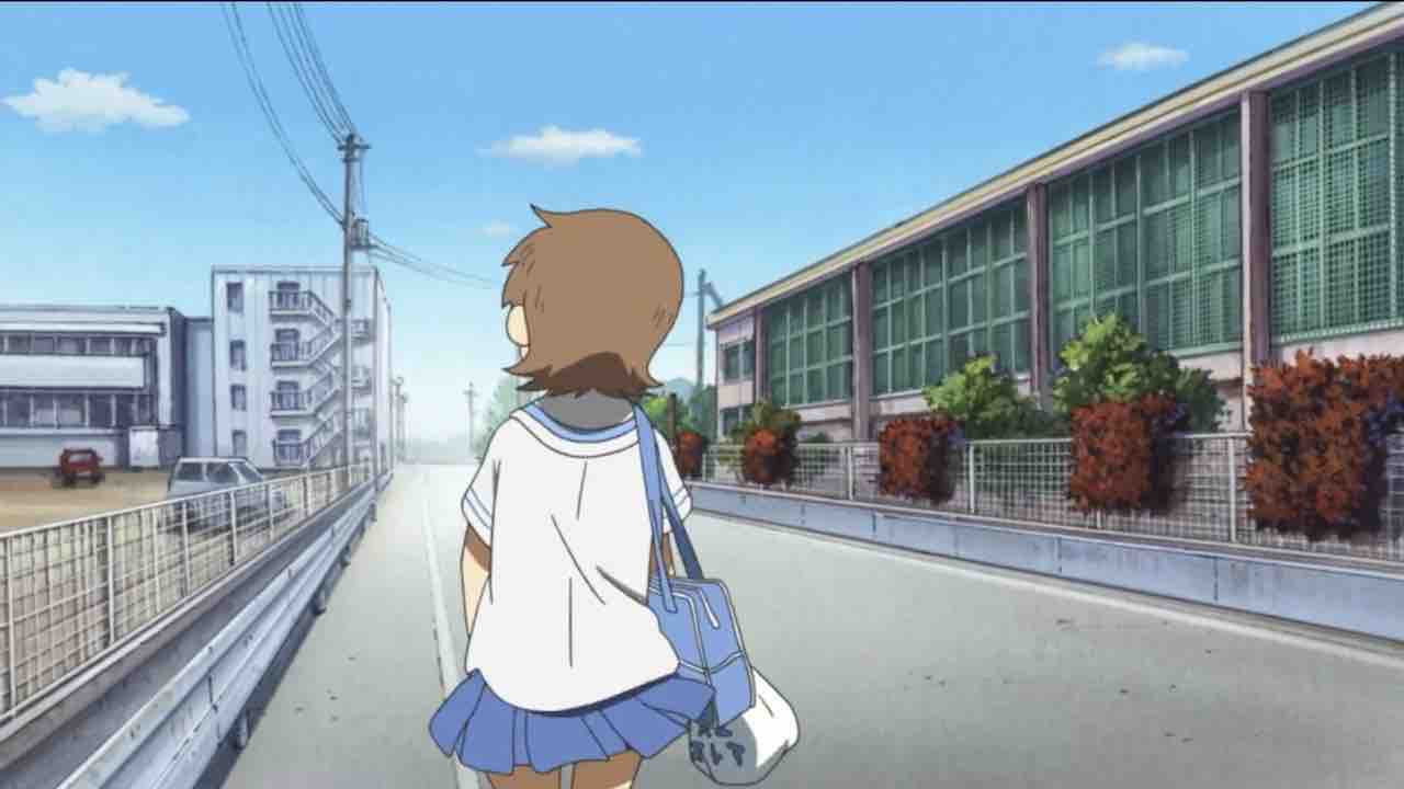
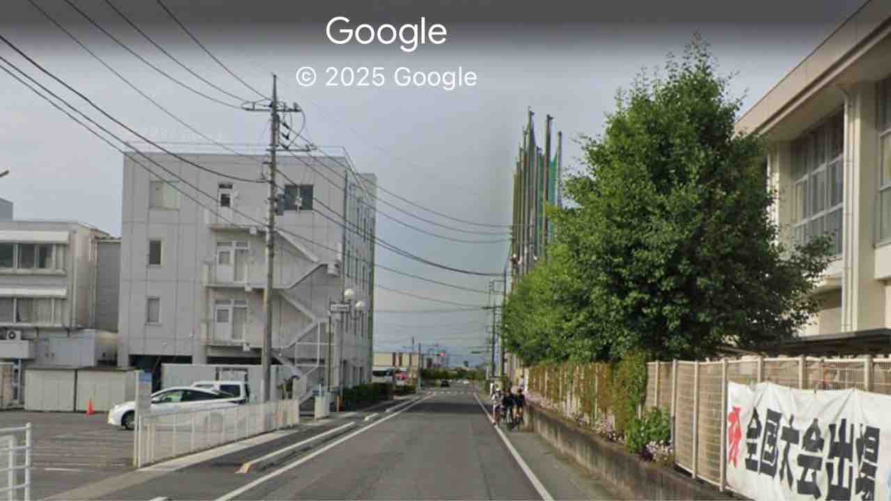
Areas such as the back of the school building are also used as backgrounds in the anime.
Map
https://maps.app.goo.gl/mztpsFn2WGE2kjVLA
SUBARU Isesaki Plant Chimney
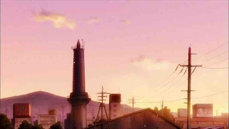
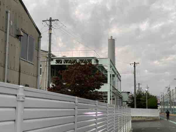
The chimney located within the SUBARU Isesaki Plant. This is the model for the chimney where the boy landed after colliding with Nano and being sent flying in the first episode. Note that the background depicted behind the chimney in the anime is original to the show.
Map
https://maps.app.goo.gl/Di2LYPV6a5bHETTW8
Kezoji Park Amusement Park
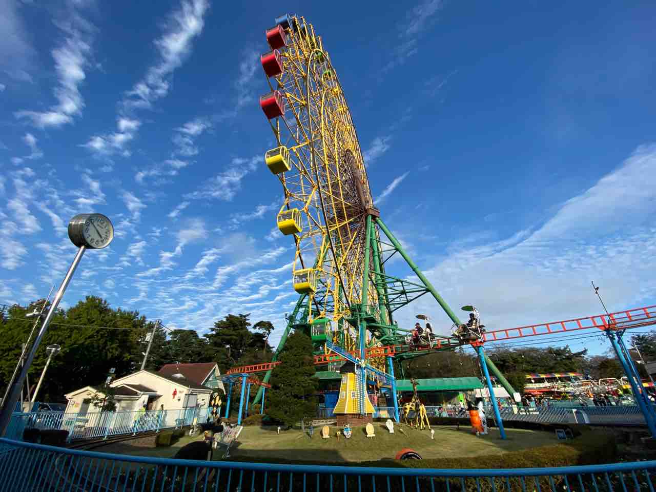
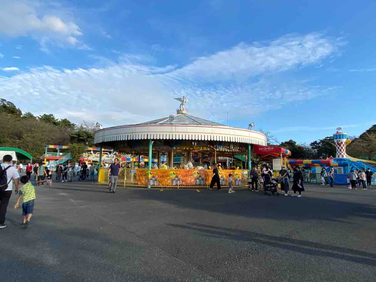
The amusement park where Yukko and Mio went to play.
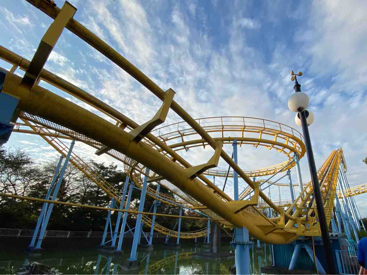
It also features the roller coaster that Yukko rides with a deadpan expression after losing 4,016 yen.
Map
https://maps.app.goo.gl/XSHey8RhU5CcBN5m7?g_st=ipc
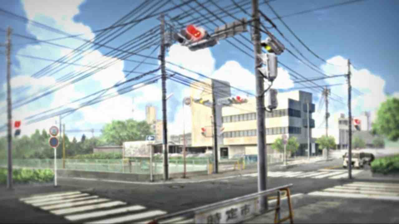
Kezoji Park South Intersection (Nichijou 2nd OP – Yukko’s Fast-Forward Part)
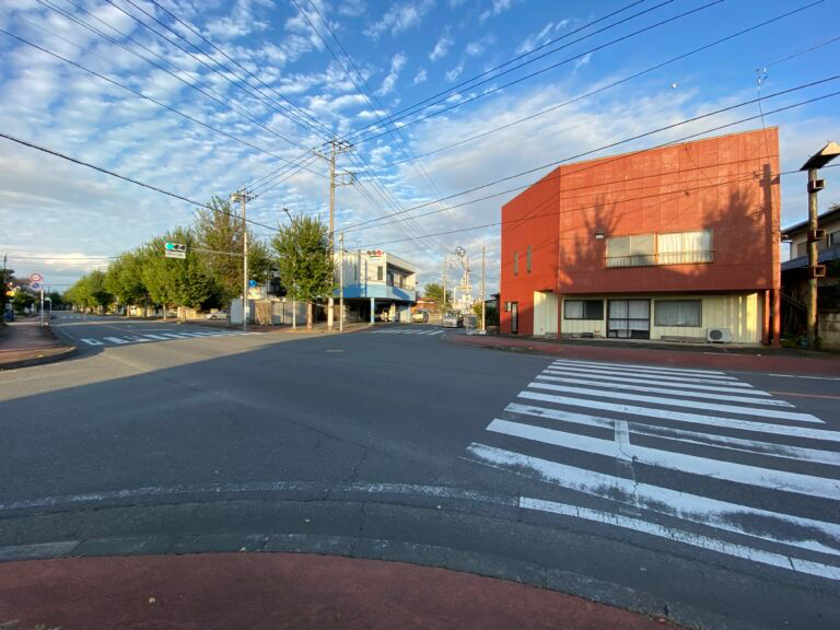
The intersection used in the time-lapse scene of the second opening (OP) of “Nichijou.” Currently, this is the pilgrimage site in Isesaki City that best retains the “Nichijou” aesthetic.
Map
https://maps.app.goo.gl/oSfPKinytgyfWy3s7
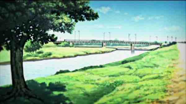
Hiragama River Bridge 4-1 (Nichijou 2nd OP – Mio’s Fast-Forward Part)

The river bridge used in Mio’s time-lapse part in the second OP. It crosses the Hiragama River, a tributary of the Hirose River mentioned later. The bridge has no formal name and is identified by the management number “4-1.”
Map
https://maps.app.goo.gl/UxDjjNaL8a4Ac6fv6?g_st=ipc
Under the Ryomo Line Viaduct (Nichijou 2nd OP – Mai’s Fast-Forward Part)
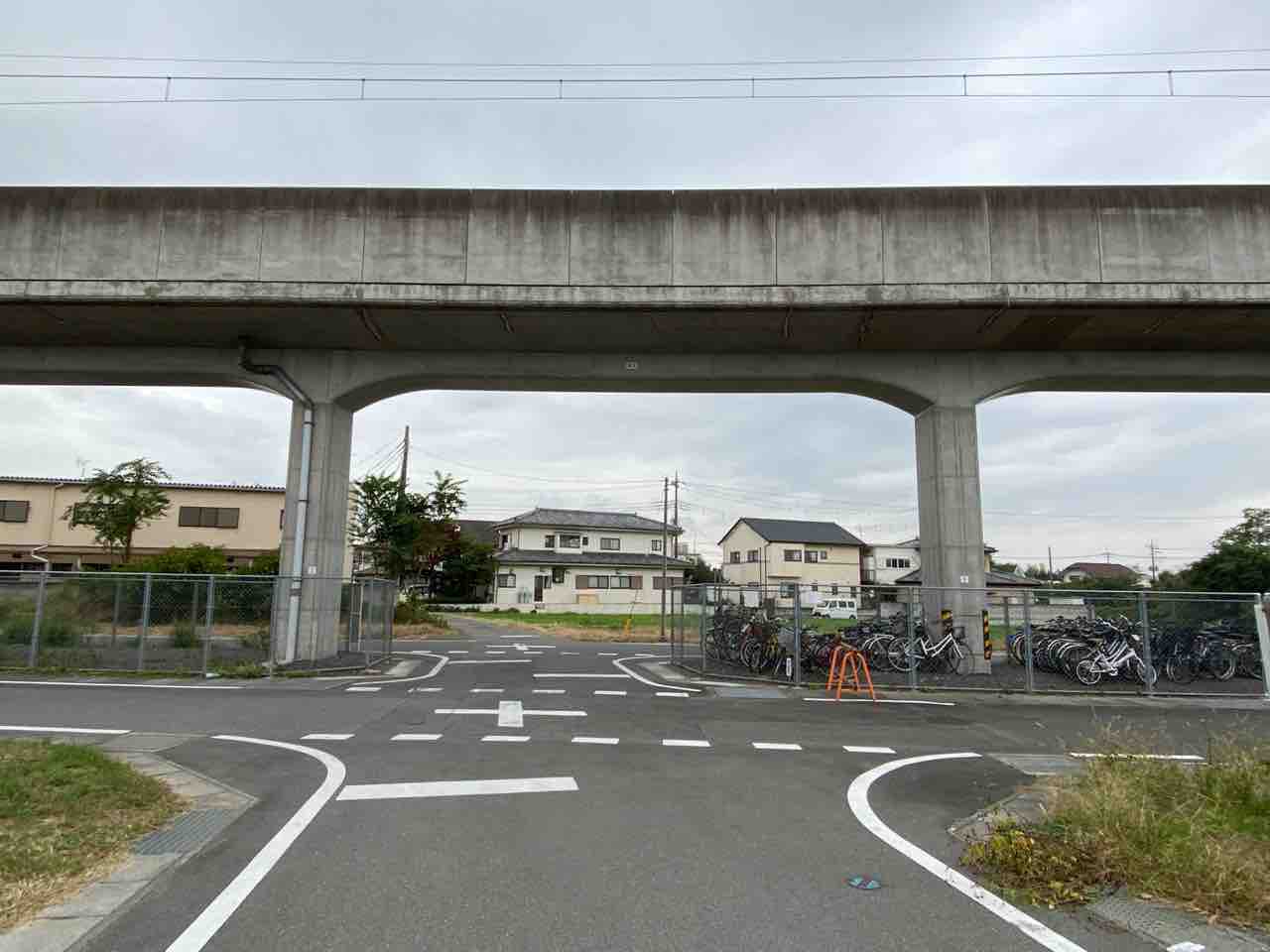
The Ryomo Line viaduct used in the time-lapse scene of the second OP. It is also featured on the cover illustration of “Nichijou no Himekuri CD Sono 3.”
In the OP, ground-level tracks and a railroad crossing were depicted along with the viaduct, but in reality, only the viaduct exists. It is likely that the OP movie captured the scene during the construction to elevate the Ryomo Line.
Since the main anime story takes place after the elevation was completed, the combination of “High school student Mai and the ground-level crossing” is technically an impossible pairing in the timeline.
Map
https://maps.app.goo.gl/VNt8iHUDEfKbqyhXA?g_st=ipc
Under the Ryomo Line Viaduct (Nichijou 2nd OP – Nano’s Running Scene)
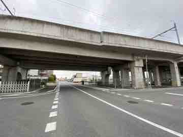
The railway viaduct right next to the Shinonome Laboratory (vacant land). It was used in the scene where Nano runs off to school in the second OP.
Map
https://maps.app.goo.gl/ANsRoB733y87hYHJ9?g_st=ipc
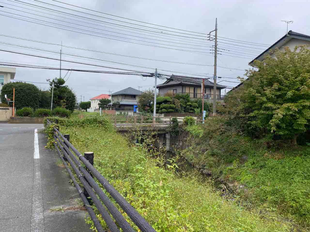
Hirose River Bank / Near Sakae Bridge
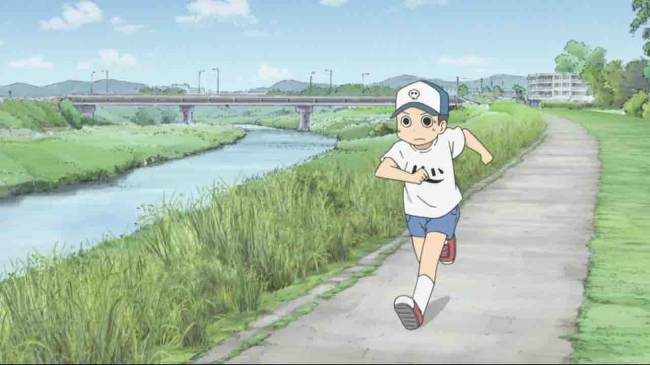
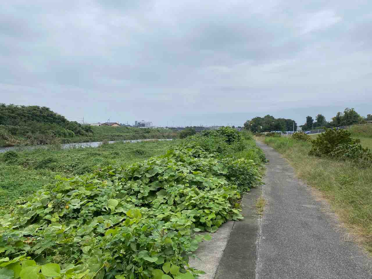
The path along the river where Kiyoshi was chasing Buddy. The model for the anime location is roughly under the bridge called “Sakaebashi” on the edge of the Hirose River.
Map
https://maps.app.goo.gl/b1dinem1fgocubUg6?g_st=ipc
Mos Burger Isesaki Kezoji-mae
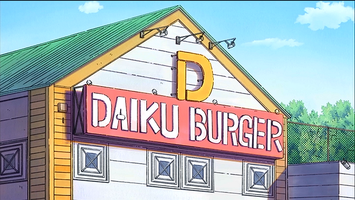
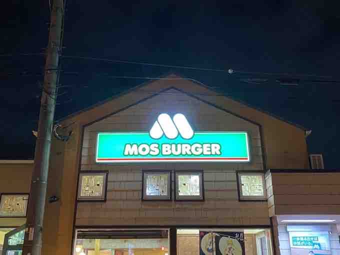
The shop that served as the model for “Daiku Burger.” The characteristic trapezoidal shape of the building is exactly as seen in the anime.
Map
https://maps.app.goo.gl/PryzrJGQuZNrcmV48?g_st=ipc
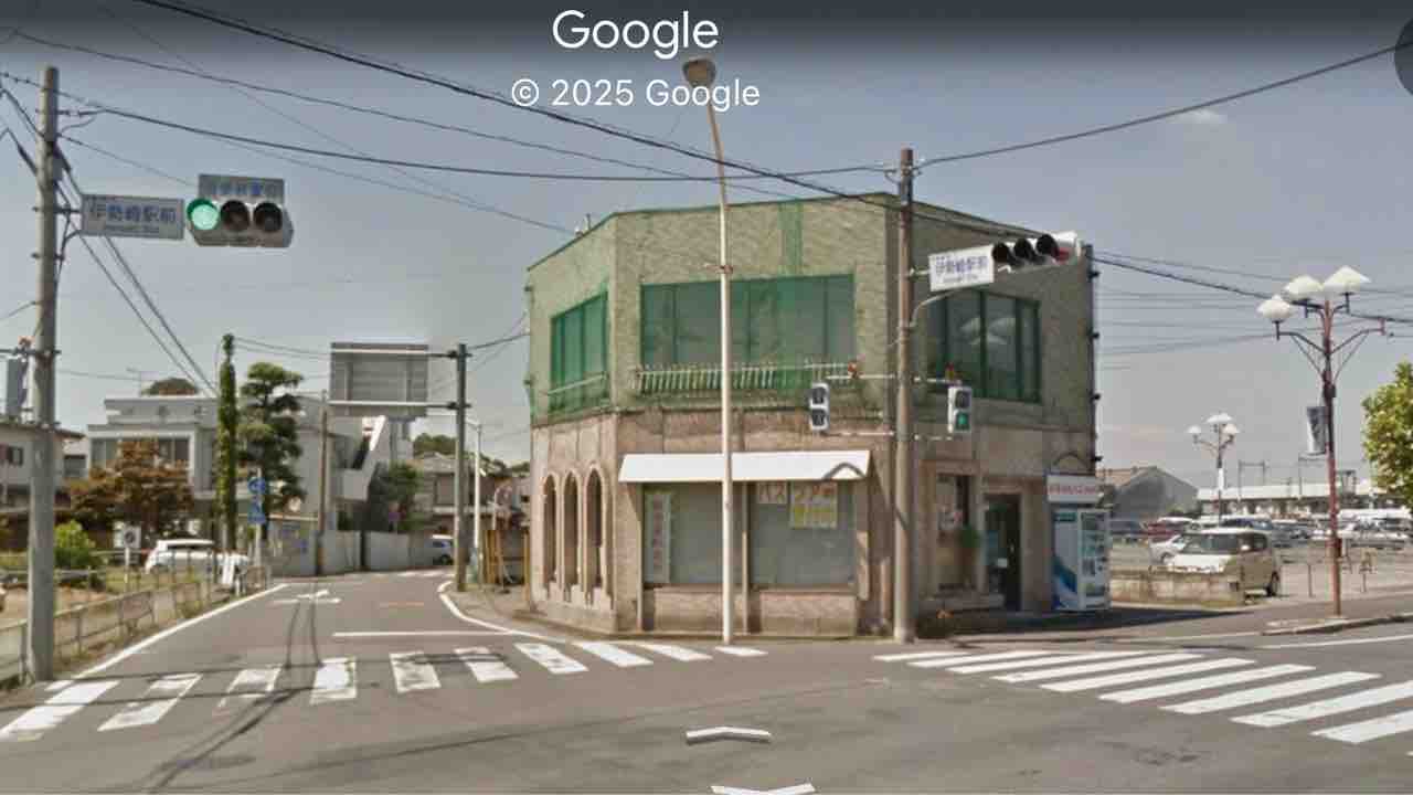
Intersection in front of the Shinkyo (Credit Union)
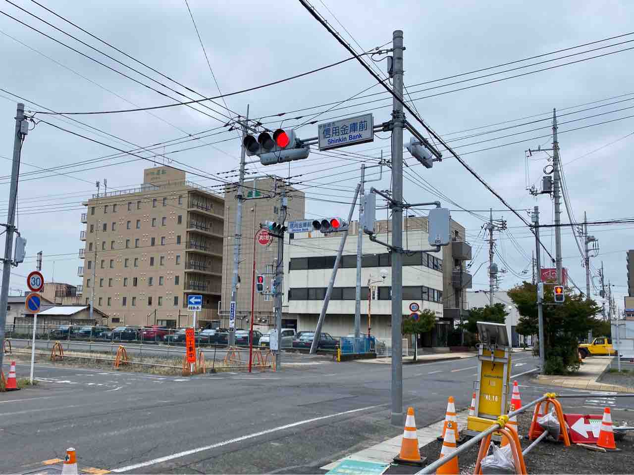
A background used in the mini-animations between segments. As of 2025, an extension has been added to the building on the left side of the photo, so the view looks slightly different from the anime.
Map
https://maps.app.goo.gl/UsztJPkcs3fZLM767?g_st=ipc
Kasukawa River Bank (Main Story)
The point believed to be the model for the river bank where Misato Tachibana and Mihoshi Tachibana were walking on their way home.
Map
https://maps.app.goo.gl/VdvqDuENQ31qybG66?g_st=ipc
Hirose River near Mitsuya Bridge
Appeared as a background in the interlude animation of episode 23. As of 2025, railings and other features have been added to the shore.
It is also believed that the spot where Mio Naganohara rescued the boy is near this Mitsuya Bridge.
Map
https://maps.app.goo.gl/VXFBVw31PL5SajUr8?g_st=ipc
Kasukawa River Bank (1st ED)
The model for the scene in the first ending where the “Sucharaka Trio” are floating leaf boats down the river.
Map
https://maps.app.goo.gl/Uj4qWpkB937bCsZU8
Machikado Station Hirose
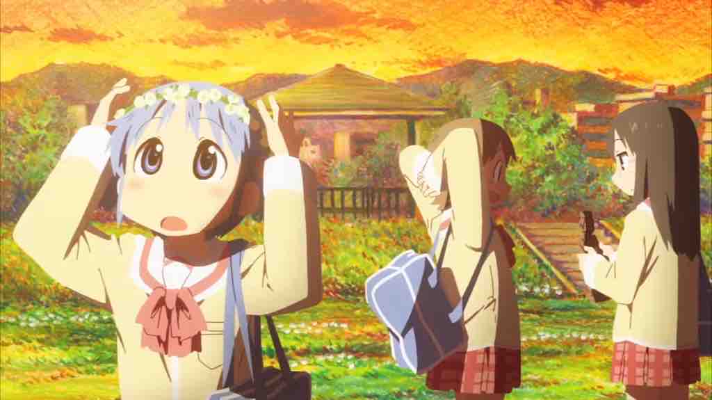
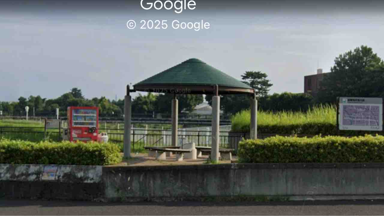
A public facility located along the Hirose River, south of Sakae Bridge. It is operated as a rest area for the adjacent cycling road.
In the anime “Nichijou,” it was used as a background for the first ED. An arbor (gazebo), which is one of the facilities, is depicted in the background.
*Information provided by: Mr. Retnuc
Map
https://maps.app.goo.gl/x8PLfErcXR3Jjyxp6?g_st=ipc
Kuruwa-cho, Isesaki City
One of the background models for the video game “Nichijou: Uchuujin.”
Map
https://maps.app.goo.gl/L84nL1DvQUEhS7DH9?g_st=ipc
Prefectural Road 74 Intersection
One of the background models for the video game “Nichijou: Uchuujin.”
Map
https://maps.app.goo.gl/2qpEDoZVDRpdXDvr6?g_st=ipc
Tokue Shoten (Tokue Store)
One of the background models for the video game “Nichijou: Uchuujin.”
Map
https://maps.app.goo.gl/LsUiWh6ZyemMMiM78?g_st=ipc
Honmachi-dori
One of the background models for the video game “Nichijou: Uchuujin.” Many shops here collaborated in the events “Isesaki City x Nichijou” and “Isesaki City x CITY.”
Map
https://maps.app.goo.gl/kBwW1ziaxqPYfUZ56
Beetle and Stag Beetle Objects (Tokisadame Park)
One of the background models for the video game “Nichijou: Uchuujin.” It is located in the aforementioned Kezoji Park area. While not explicitly stated in the anime, the area corresponding to the real “Kezoji Park” is believed to be named “Tokisadame Park” in the series.
Map
https://maps.app.goo.gl/Rjvk9HTmmjSQircX8
Maebashi City
The birthplace of Keiichi Arawi. While Mr. Arawi is generally known as a prominent figure from Isesaki City, he was actually born in Maebashi and graduated from Maebashi’s Arato Junior High School. His deep involvement with Isesaki City began later, during his high school years.
Backdrops from various shopping districts within Maebashi City were used as models for “Tokisadame Shopping District” in the anime.
It appears that elements from multiple shopping districts were combined to depict the single “Tokisadame Shopping District” in the anime. Elements from a shopping district entrance in Hachioji City, Tokyo, also seem to have been included.
Maebashi Chuo-dori Shopping District
(Street View from 2012)
The model for the shopping district appearing in Episode 21. It is presumed that the area around Chiyodacho Pharmacy along the street served as the background model.
(Scenery as of 2024)
By 2024, the vending machine corner and other features had been removed, and the landscape resembling the anime has disappeared.
Map
https://maps.app.goo.gl/oTBQ1EaWgFFZFWja8?g_st=ipc
Maebashi Orion-dori
One of the models for the shopping district in Episode 21. The roof shape from Orion-dori was adopted for the anime.
Map
https://maps.app.goo.gl/6CXJ18JBu2JEfesA8?g_st=ipc
Sweet Potato (formerly Oimoya-san Koushin Maebashi Branch)
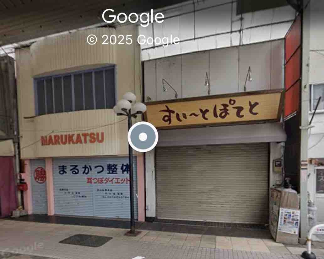
The model for the sweet potato confectionery shop is on the right side of the image above. A similar sweet potato specialty shop is located in the same position.
Please note that this shop is located in “Benten-dori,” which is different from the previously mentioned Maebashi Chuo-dori and Maebashi Orion-dori. At the time of the anime adaptation, it was named “Oimoya-san Koushin,” but the shop name has since changed.
While a clothing store is depicted on the left side in the anime, a chiropractic clinic actually occupies that space.
Map
https://maps.app.goo.gl/pp5Jy7m2RgqDJiee9?g_st=ipc
Otonedo Stationery Store
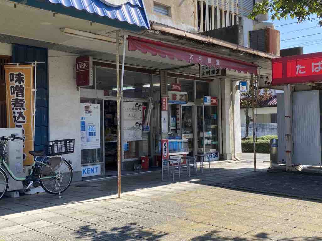
The stationery store used as the background for the cover of “Nichijou” Volume 6. The shop owner’s son was a classmate of Keiichi Arawi, which led to it being used for the cover. Inside the store, items such as Mr. Arawi’s autograph and copies of Shonen Ace are on display.
Map
https://maps.app.goo.gl/nrc1op6fqHFf7SKB9?g_st=ipc
Takasaki City
While the direct relationship between Takasaki City and Keiichi Arawi is unknown, it is likely a familiar area to him as it neighbors Maebashi City.
Two locations within Takasaki City were used as background models.
Takasaki Tonyamachi Station
The model for “Tokisadame Tonyamachi Station,” the setting for the scene in Episode 12 where Yukko encounters Mihoshi and ends up feeling deeply embarrassed.
Map
https://maps.app.goo.gl/RM29zpftEKXEjyo86?g_st=ipc
Takasaki Saya-mall Shopping District
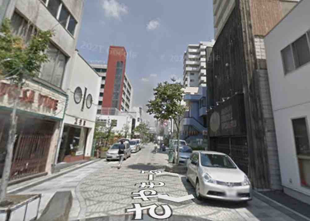
(Street View from 2012)
(The scene during a visit in 2025)
The model for the shopping district that appears following the Takasaki Tonyamachi Station in the Episode 12 encounter between Yukko and Mihoshi.
The building in the image above matches the exterior of the building with the “P” mark in the anime reference image. As of 2025, the building in the foreground has been replaced by a taller structure, making it impossible to see the same view as in the anime.
Map
https://maps.app.goo.gl/jyS2LsTKoUDiidMs6?g_st=ipc
Pilgrimage Sites Where Scenery Has Vanished Due to Redevelopment
Isesaki Otemachi Post Office
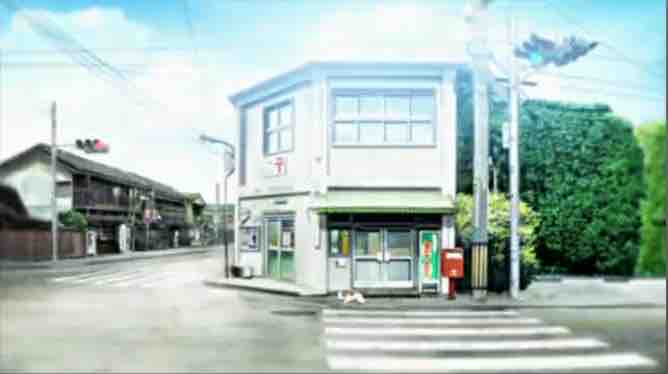

(Street View from 2012)
The background used in the mini-anime between parts.
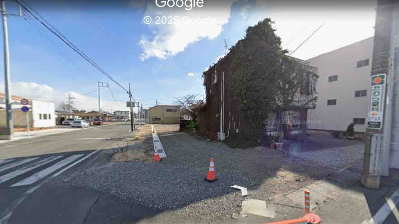
(Street View from 2023)
A post office once existed here, but it has closed and the building has been demolished.
Of the structures depicted in the anime, only the road, traffic lights, and the greenery-covered building next to the post office remain.
Map
https://maps.app.goo.gl/W1LyBqo1VGjxYt5J7?g_st=ipc
Isesaki Station Intersection
(Street View from 2012)
The intersection where Mio witnessed the “Moderate Miracle” of people wearing rainbow-colored clothes by chance.
(Isesaki Station Intersection as of 2022)
Due to ongoing redevelopment, not only the buildings but the intersection itself has been relocated and repaved. Anything reminiscent of the anime scenery has completely vanished.
The photo above shows the “Isesaki Station Intersection,” which shares the same name as the holy place, but the location and scenery are entirely different.
Map (Current Isesaki Station Intersection)
https://maps.app.goo.gl/oc1PsREbjPW2Whv59?g_st=ipc
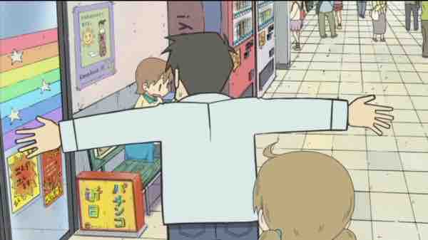
Isesaki Station Bus Stop (Daiku Bus Stop)
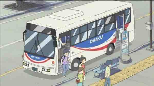
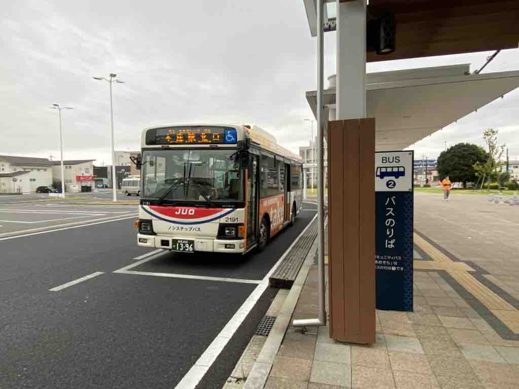
(Isesaki Station Bus Stop as of 2022)
The bus stop where Yukko got off after failing to press the button in time. The scenery of the Isesaki Station bus stop at the time was used directly in the anime, but it has completely disappeared due to redevelopment.
Map
https://maps.app.goo.gl/cu9ES3GXRRyqWp5x7?g_st=ipc
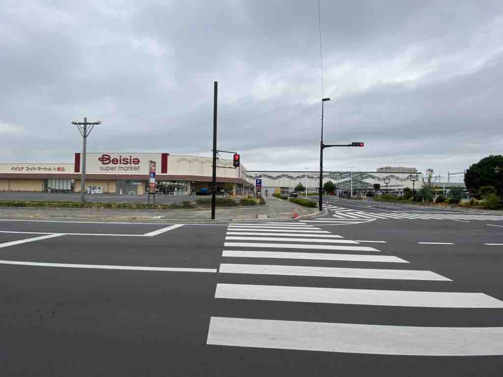
Super Ota
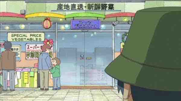
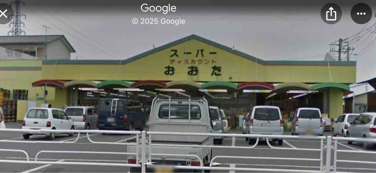
(Street View taken in 2012)
The supermarket where Nakamura-sensei was lying in wait for Nano.
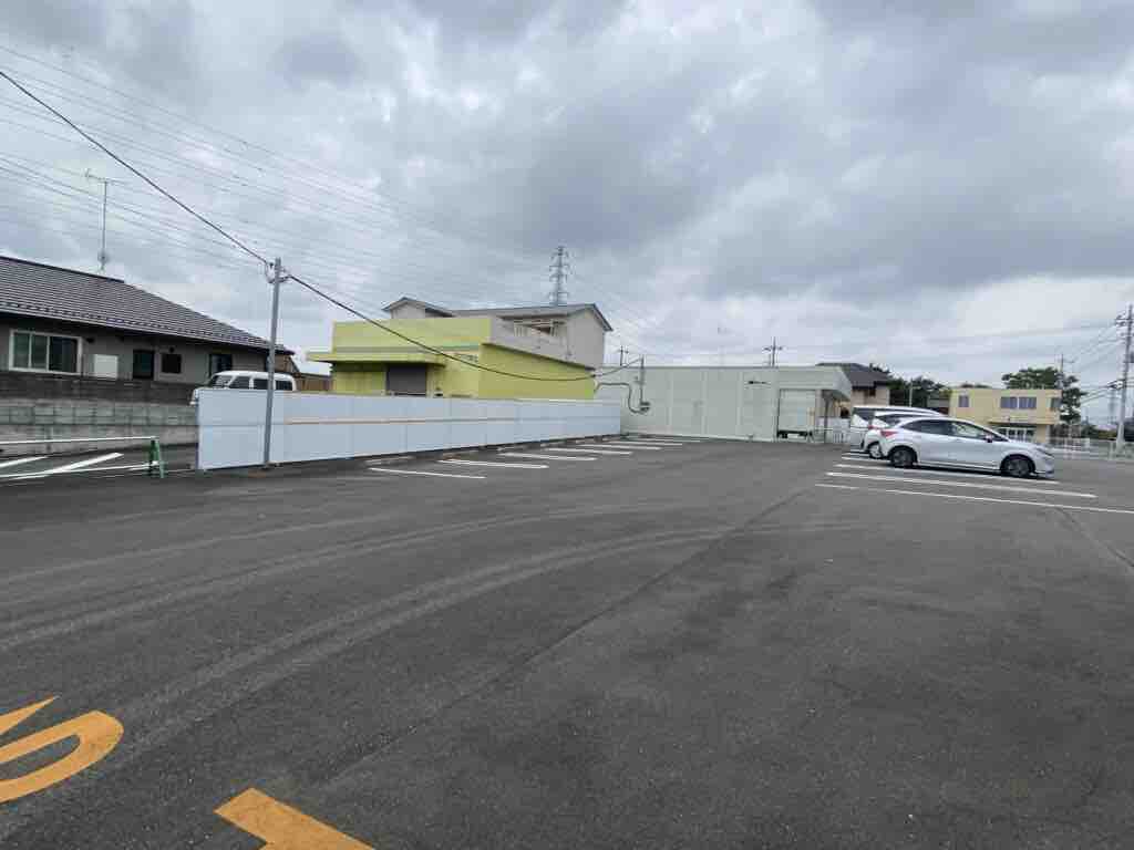
It has since closed down or been demolished, and another shop or parking lot has been built in its place.
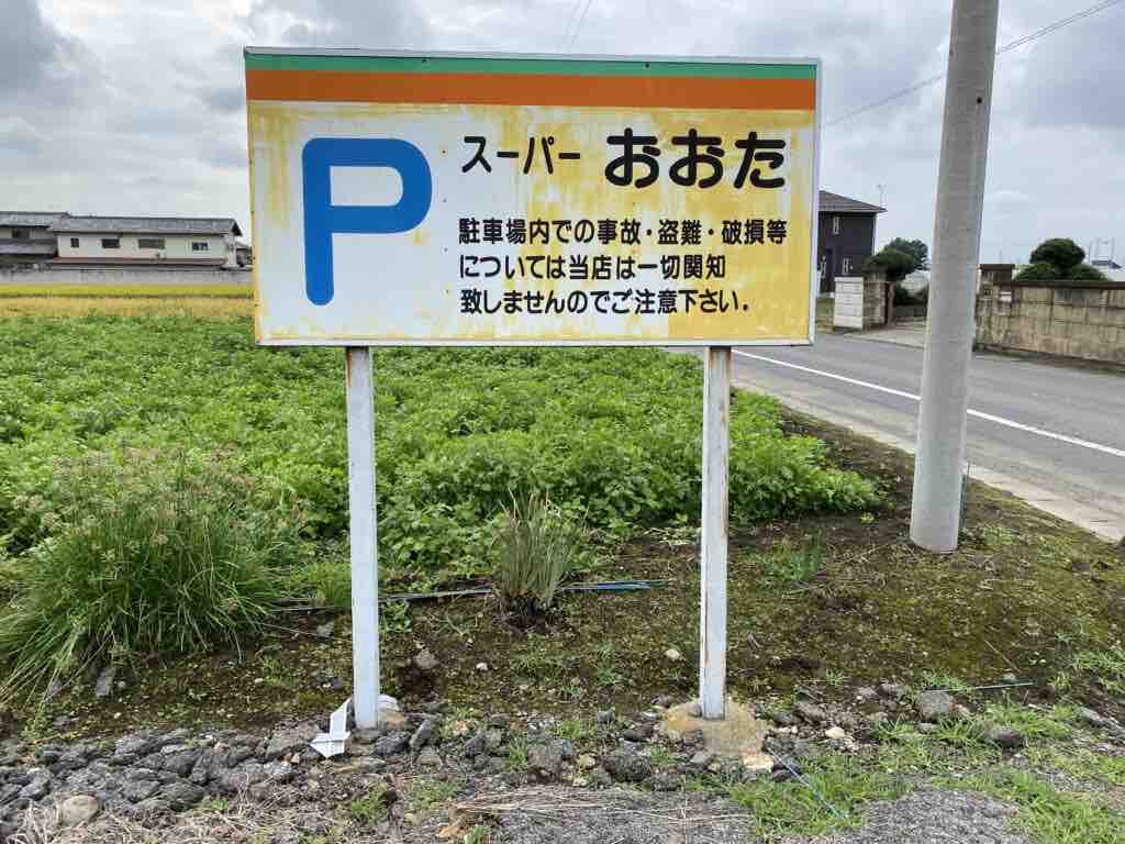
At the time of the blogger’s visit (around 2022), the “Super Ota” sign still remained, allowing a glimpse into the past.
Map
https://maps.app.goo.gl/iEpTY4qu6qebfgmx8?g_st=ipc
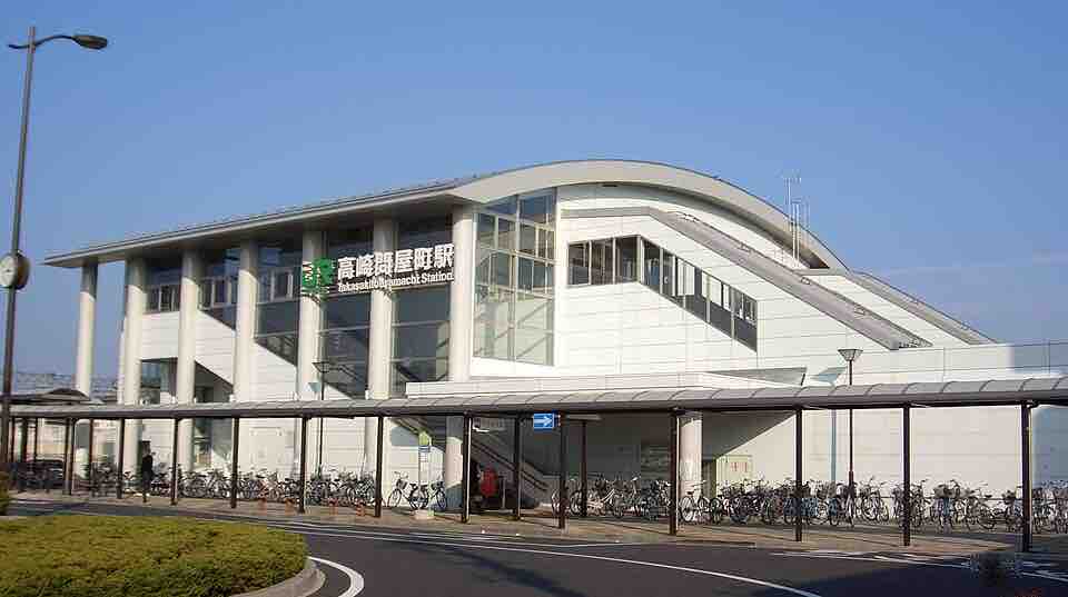
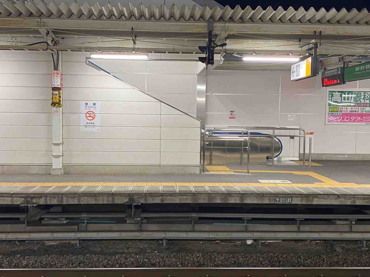
Isesaki Station
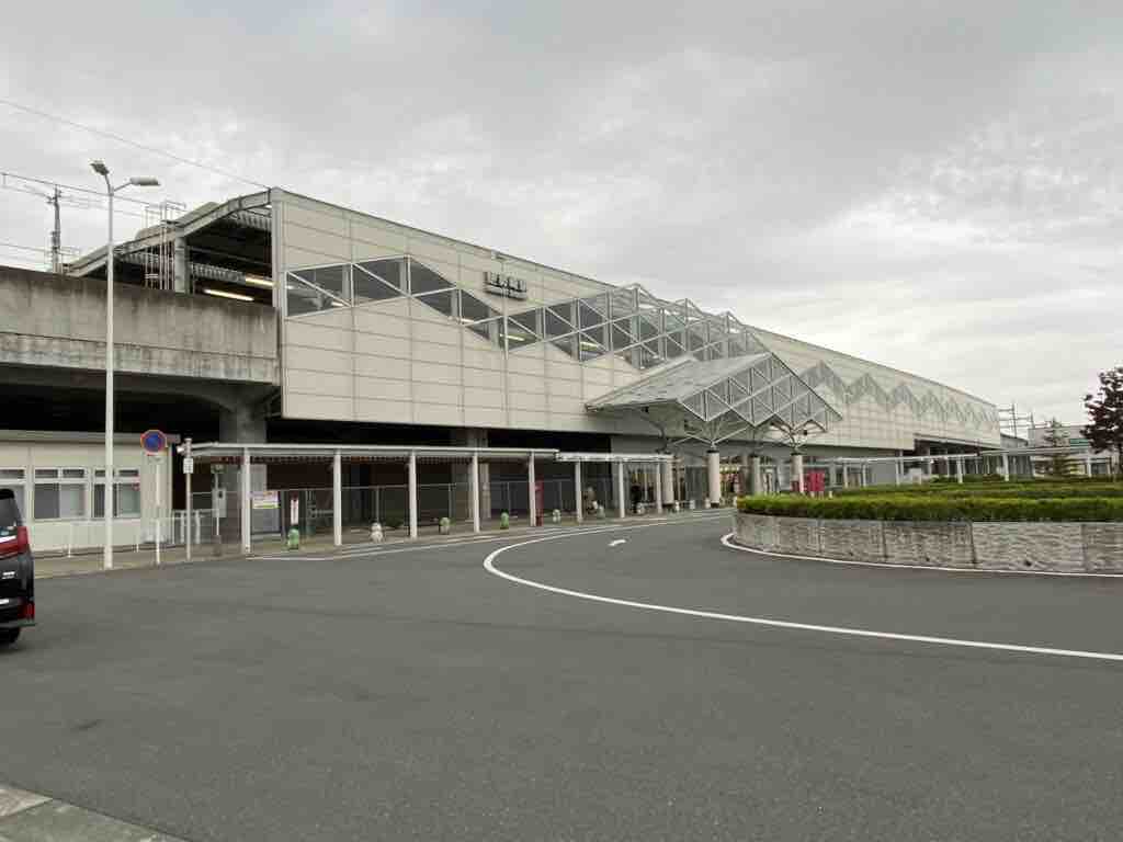
The central station of Isesaki City. In Episode 0 of the anime, the interior of the old station building was used as the background for Tokisadame Station, but it has since been rebuilt due to an elevation project. The photo shows the current station building.
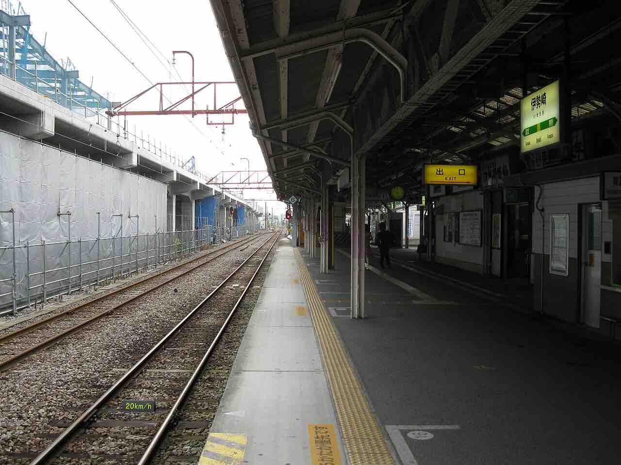
(Isesaki Station platform during the ground-level era • LERK • CC BY 3.0)
The station interior as depicted in the anime. Since it has now been elevated, the scenery seen in the image above has disappeared.
Map
https://maps.app.goo.gl/qAnkFPNjzqvHpCft6?g_st=ipc
Bonus Section
Annaka-Haruna Station
A station on the Hokuriku Shinkansen line located in Annaka City, Gunma Prefecture. It is believed to be the namesake of the “Nichijou” character, Haruna Annaka.
Despite being a Shinkansen stop, it is famous among railway fans as a “hikyo-eki” (secluded station) because there is almost nothing in front of the station.
Map
https://maps.app.goo.gl/aR2bC1yUNxp9BM436?g_st=ipc
Joshin Dentetsu 700 Series (Former JR East 107 Series)
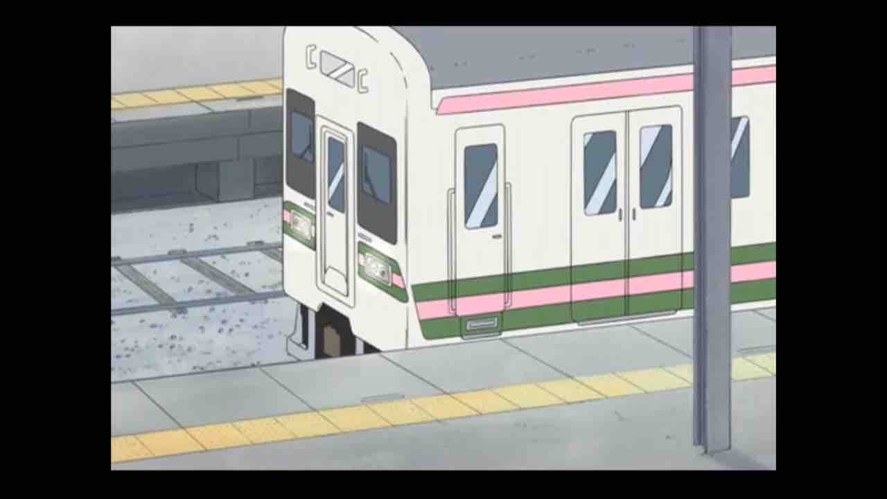
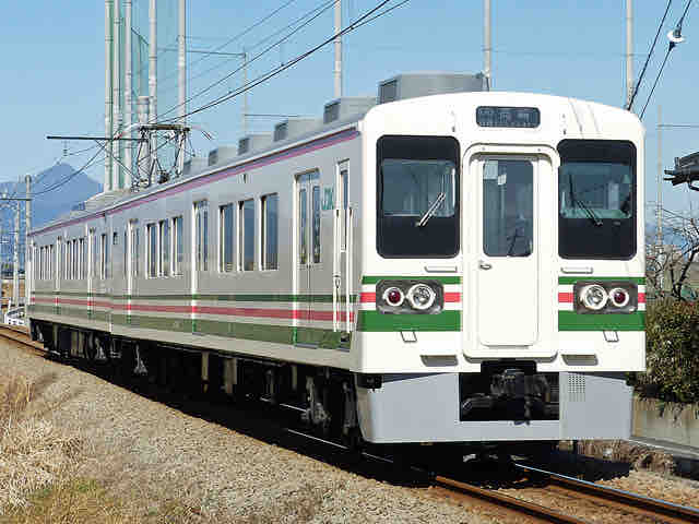
*Image from Wikipedia (Nyohoho • CC BY-SA 4.0)
The train that appears in the original manga and anime. At the time of the anime’s release (2011), this model was the mainstay of the JR Ryomo Line, which serves Isesaki Station (Tokisadame Station).
After retiring from the Ryomo Line in 2017, five sets were transferred to Joshin Dentetsu. While most were repainted in Joshin’s original colors, one set has maintained its original Ryomo Line livery.
As of 2023, it is still possible to ride a train with the exact same colors as seen in “Nichijou” on the Joshin Line. (Note: It may not be in service every day due to maintenance.)
Map (Takasaki Station / Joshin Dentetsu Platform)
https://maps.app.goo.gl/XoiL2gnPY55JoJYz8?g_st=ipc
Kokusai Juo Bus (Daiku Bus)
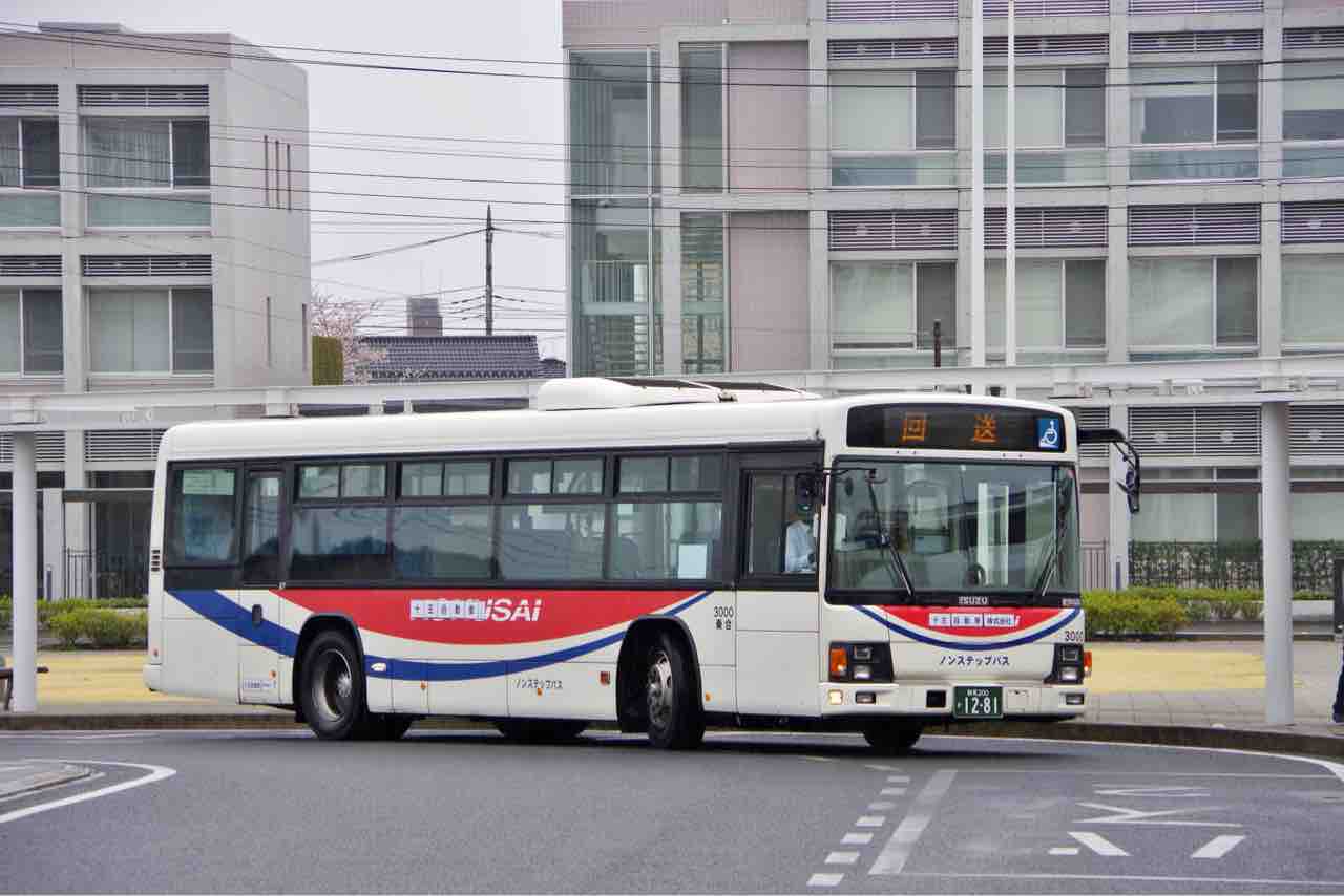
*Image from Wikipedia (Tky_910_A3 • CC BY-SA 4.0)
The livery of the “Daiku Bus” in the anime is based on the Kokusai Juo Bus. However, likely to avoid copyright issues, the red and blue colors are inverted.
Between 2004 and 2021, Kokusai Juo Bus had merged with “Juo Jidosha,” which operated within Isesaki City. The design used in the anime originates from this era.
Today, buses with this specific livery have almost completely vanished from the area. To see this color scheme now, you would need to visit Saitama Prefecture, such as the Kumagaya area.
Map (Kumagaya Station Bus Stop)
https://maps.app.goo.gl/hQJ1zqjznNYRURpr7?g_st=ipc
Chicomart
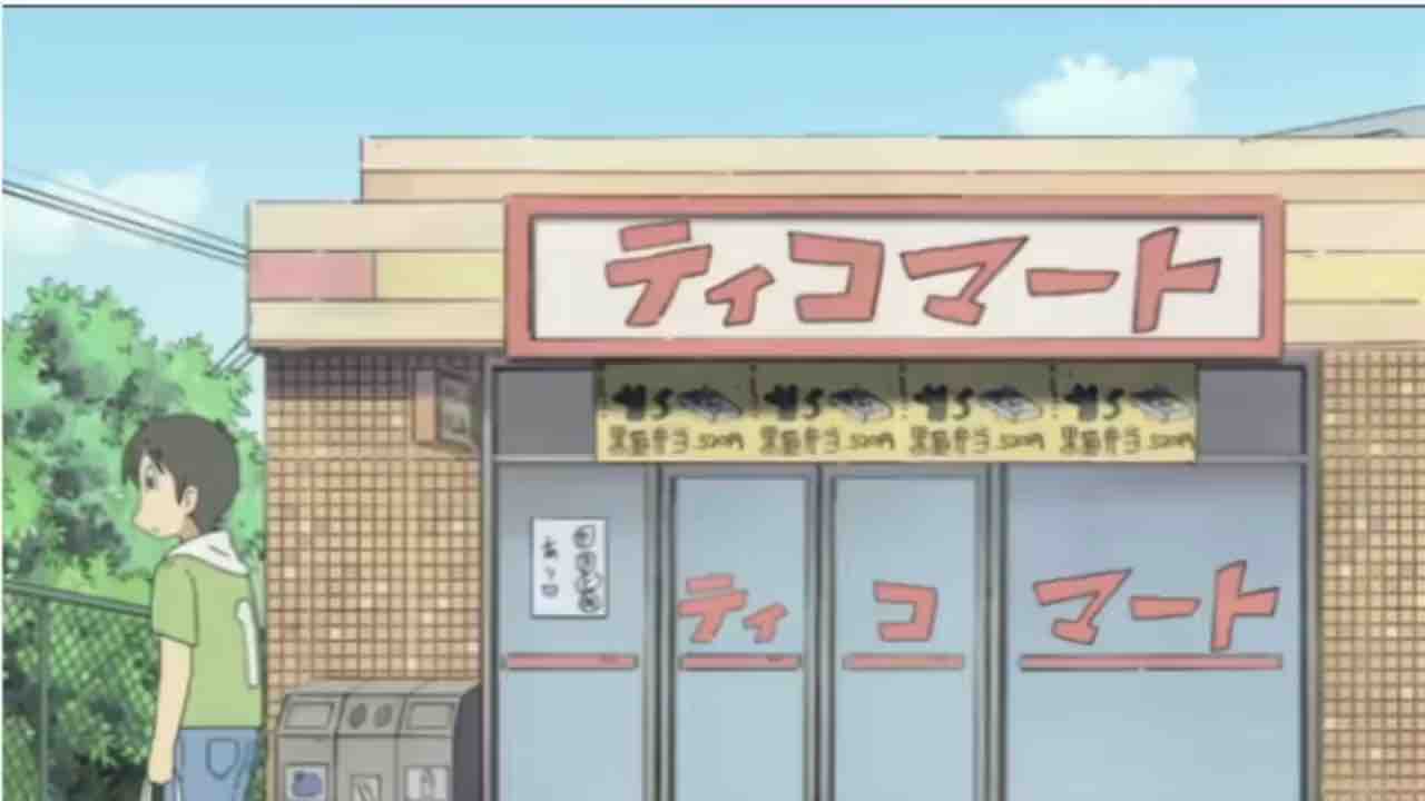
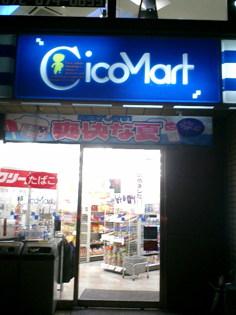
*Image from Wikipedia (©Mr. Chura-san CC BY-SA 3.0)
A convenience store chain that expanded across Japan from 1984 to 2005. At its peak, it had over 200 stores nationwide but went bankrupt in 2005.
While it is considered the inspiration for “Ticomart” in “Nichijou,” the visual model for the store’s exterior is believed to be a Lawson in Hachioji City, Tokyo.
Although Chicomart no longer exists as a corporate entity, several independently owned shops using the name still exist today, primarily in the Kansai region.